River, lake and haor, Jamalpur
Bahadurabad Ghatবাহাদুরাবাদ ঘাট
- Time needed
- An hour at the river, more if you take a boat.
- best months
- Nov–Feb
The Jamuna ghat at the end of the railway in Dewanganj, where from 1912 whole trains were ferried across the river to Tistamukh; the rail ferry is gone since the Jamuna Bridge, the river and the ghat remain.
Plan your visit
- Best time
- Winter for the sandbanks and the light; the monsoon for the width of the river.
At a glance
- Railway reached
- 1912, from Jamalpur
- Rail ferry
- To Tistamukh Ghat, until the Jamuna Bridge (1998)
- Where
- Dewanganj upazila, on the Jamuna
About
For most of the twentieth century this was how the east of Bengal reached the north. The Dhaka State Railway came up from Narayanganj to Mymensingh in 1885, reached Jamalpur in 1894 and was pushed to the Jamuna bank at Bahadurabad in 1912; from here a rail ferry carried the carriages across to Tistamukh Ghat on the Gaibandha side and the line on to Rangpur and Dinajpur. Jute from the north went down to Narayanganj and Kolkata this way, and passengers changed from train to ferry to train. When the Jamuna Bridge opened in 1998 the ferry stopped and the station became a terminus, then a memory.
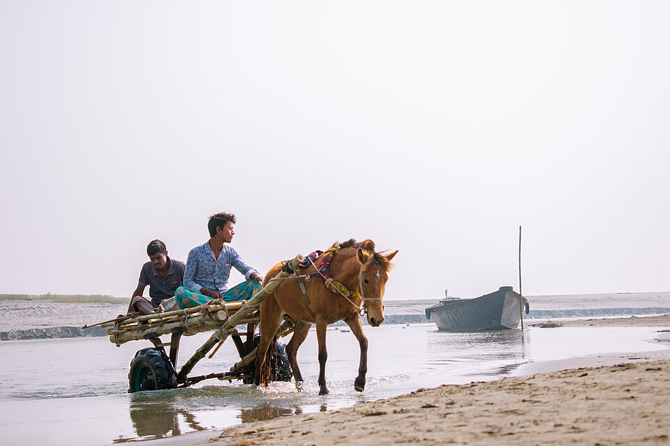
What is left is a wide, slow stretch of the Jamuna with chars in it, the old ghat and the station buildings, boats crossing to the Gaibandha chars and a riverbank where the town of Dewanganj comes to sit in the evening. In the rains the river is a sea; in winter the sandbanks are enormous. Come for that, and for a sense of how the country used to move.
Getting there: Train from Dhaka or Jamalpur to Dewanganj, then an auto to the ghat; or by road from Jamalpur town, about 45 km.
Things to do
- Walk the old ghat and station, then take a country boat out onto the Jamuna.
- Stay for sunset over the river.
Good to know
- Agree the boat fare before you get in; the current is strong in the rains, so stay with an experienced boatman.