Hills and mountains, Sherpur
Panihata-Tarani hillsপানিহাটা-তারানি পাহাড়
- Time needed
- An hour or two.
- best months
- Oct–Feb
- Cost
- Free. A motorcycle from Nalitabari and back is about ৳150 (2025).
Two border villages at the foot of Meghalaya's Tura hills, where the Bhogai river comes out of the mountains over a bed of pebbles; the clearest view of the hills in Sherpur, and the quietest.
Plan your visit
- Best time
- November to February for clear hills; after the monsoon the river is fullest and the hills greenest.
At a glance
- Where
- Ramchandrakura union, Nalitabari, on the Meghalaya border
- River
- The Bhogai, where it leaves the hills
- From Nalitabari
- About 13 km, 35–45 minutes
About
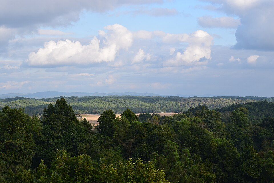
Panihata and Tarani lie in Ramchandrakura union, about 13 km north-east of Nalitabari town and 25 km from Sherpur, just past the Nakugaon land port. There is nothing built for visitors here, which is the point. The Bhogai leaves Meghalaya a few hundred metres away and runs west in front of the villages, shallow and clear over rounded pebbles that shine in the sun; across it the Tura hills climb straight up, often with cloud sitting on the higher ridges.
On the Bangladesh side a low ridge gives the view: the river, the border pillars, the green wall of hills behind. The villages are Garo and Bangali, with a Catholic mission beside the river that runs a church, a small clinic, a school and a hostel for pupils from the hill villages.
People come to sit on the pebbles, wade in the cold water, and watch the light change on the hills. Combine it with Madhutila or Baromari on the same road.
Getting there: From Nalitabari's Garkanda Chourasta go north to just before Nakugaon land port, turn east over the Bhogai bridge, continue about 3 km to China Mor, then 1 km north; a CNG, auto or hired motorcycle does it in 35–45 minutes. Coming from Dhaka, the Nakla–Nalitabari road is shorter than going through Sherpur town.
Things to do
- Walk on the pebble bed of the Bhogai and wade across the shallows.
- Climb the ridge for the view of the Tura hills.
Good to know
- Stay on the Bangladesh side of the border pillars; the BGB patrols here.
- The river rises quickly after rain in Meghalaya, even on a dry day here.
- No shops at the point: bring water.